Just over 6 years ago I wrote a series of entries about using a budget smartphone with Viewranger as a mapping GPS tool. I bought a fair few tiles of offline maps for UK, Spain and Tenerife and found it to be a great tool. My waterproofing was a freezer bag and as I try to avoid being out in foul weather this worked well, although on occasion I moved the phone inside my waterproof jacket.
I had no need to change system as it was self contained and with adequate power and space. An 8GB SD card seemed to be practically limitless. Unfortunately Viewranger were bought up by Outdooractive and so the app and tiles became obsolete in February 2022. There is plentiful online debate about the problems with the Outdooractive app, much of which I disagree with. However it does need more resources and the closure of the Viewranger server means that fresh tiles can't be bought. My old Alcatel phone GPS works fine as is but can't have fresh maps if I travel to a new area. The Android 4.4 operating system means that it won't run the OS app either. I tried an old spare Moto phone with opensource OruxMaps but once again, the processor wasn't able to cope.
So I was back to considering Garmin hardware, opensource maps, IP68 sealed Android phones and so on. The nominally waterproof smartphones appear to fall into two categories. First are top of the range phones from major brands at a price that I wouldn't want to fall out of a pocket. Second are Chinese Android brands which have fair specifications but very mixed reviews. I almost committed to a Ulefone Armor 10X Pro at around £160 but the price was a bit more than I wanted and there are those dubious reviews....
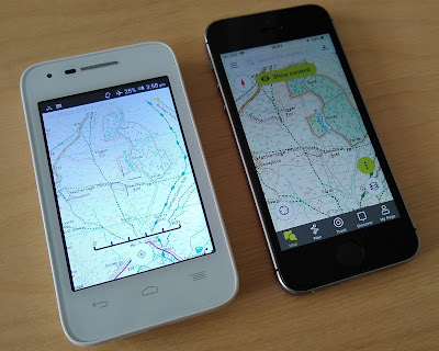
Eventually I settled on a iPhone SE (2016) with 32GB storage from BackMarket for £65. The phone is low spec by today's standards but with a 4 inch screen it's little larger than the Alcatel and actually a fair bit more powerful. Importantly it can run iOS15 which is fairly contemporary, it will not run the recently (September 2022) released iOS16. Due to the massive sales of the iPhone SE/5S there are a range of supposedly waterproof cases available and I went for a Punkcase Extreme for around £20.
I still have free access to Outdooractive Pro+ so that's my current offline map provider but hopefully this phone will give me more flexibility of provider in the future, including the mapping that comes when you buy a paper OS map.
The 'refurbished' phone is in great condition and has reportedly 91% battery health. This was my biggest concern about a used phone, would it need a new battery straight away and would that be any good anyway? After a few runs and hikes it appears that I can leave Outdooractive tracking for at least 5 hours and that it lasts for longer without live recording. The GPS shows a lock promptly even without tracking so it must be live when the phone is sleeping. As before I don't have a lock on the phone but it must be activated by two presses on the home button. This seems to be baked into iOS and I can't find a way to wake from sleep with the top button which is less than ideal.
The camera is usable and takes fairly good pictures although the HDR mode is rather to saturated for my taste. This might mean that I can save the weight of a camera but taking pictures uses a fair bit of battery life. I suppose this is mostly due to extra screen backlight usage.


